ISRO’s GSLV-F16 will launch ISRO-NASA joint satellite, NISAR, on July 30, 2025
For years, students have had the opportunity to work on a number of NASA projects through capstone projects, remote sensing coursework, and independent research with Program Director Professor Kyle McDonald, who is also part-time faculty at the NASA Jet Propulsion Laboratory (JPL). Research efforts have also been supported by Professor Nick Steiner of CCNY. The framing of much of recent research has been the joint ISRO-NASA NISAR Mission, which now has a set launch date for July 30th 2025.
Sustainability Students will be uniquely positioned to mobilize this new Mission data toward tremendous advancement is understanding climate risk and opportunities for enhanced resilience. Among current projects is a capstone looking at the impact of urban forestry on heat island mitigation, a capstone team planning to analyze the ideal sites for renewable energy based on NISAR data.
In the Spring of 2023, CCNY cohosted a workshop with NASA where participants brainstormed ways NISAR data could be used to further environmental justice causes.
Many discussions of the use cases for this extremely detailed global imagery are only scratching the surface (no pun intended), but for Professor McDonald, Professor Steiner, and students in the Sustainability Program, the launch of NISAR is a thrilling milestone following years of hard work and targeted research. See below for more information about NISAR’s capabilities and the Launch Announcement.

Mission Concept
Source: https://nisar.jpl.nasa.gov/mission/mission-concept/
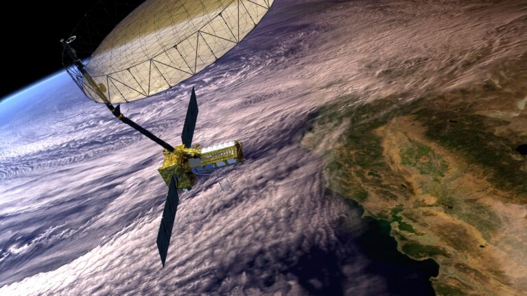
NISAR is the first satellite mission to collect radar data in two microwave bandwidth regions, called the L-band and the S-band, to measure changes of our planet’s surface, including movements as small as centimeter. This allows the mission to observe a wide range of Earth processes, from the flow rates of glaciers and ice sheets to the dynamics of earthquakes and volcanoes.
NISAR uses a sophisticated information-processing technique known as synthetic aperture radar to produce extremely high-resolution images. Radar penetrates clouds and darkness, enabling NISAR to collect data day and night in any weather. The instrument’s imaging swath — the width of the strip of data collected along the length of the orbit track — is greater than 150 miles (240 kilometers), which allows it to image the entire Earth in 12 days.
Over the course of multiple orbits, the radar images will allow users to track changes in croplands and hazard sites, as well as to monitor ongoing crises such as volcanic eruptions. The images will be detailed enough to show local changes and broad enough to measure regional trends. As the mission continues for years, the data will allow for better understanding of the causes and consequences of land surface changes, increasing our ability to manage resources and prepare for and cope with global change.
NISAR is planned to launch in 2024 from India’s Satish Dhawan Space Center in Sriharikota, India, into a near-polar orbit. NASA requires a minimum of three years of global science operations with the L-band radar, and ISRO requires five years of operations with the S-band radar over specified target areas in India and the Southern Ocean.
All NISAR science data, L-band and S-band, will be freely available and open to the public, consistent with the long-standing NASA Earth Science open data policy. NASA has chosen the Alaska Satellite Facility Distributed Active Archive Center (DAAC) to host the mission’s data and products.
See footage from the launch on our Instagram @SustainabilityCCNY